Extracting a 3D model from Google Earth can be quite a challenge, especially for those who are just starting out in the realm of 3D modeling and design. However, mastering this skill can be enjoyable! Here’s a simple guide to help you access and retrieve those 3D models for your creative projects, utilizing tools like Homestyler for enhanced design capabilities.
Getting to Know Google Earth 3D Models
Before jumping into the extraction steps, it's crucial to grasp how Google Earth facilitates its 3D models. It offers an extensive collection of geographical data, encompassing cities, public landmarks, and various landscapes, all depicted in stunning 3D. This data can be invaluable for designers, architects, and hobbyists looking to integrate realistic features into their projects. Utilizing platforms like Homestyler can help visualize these elements effectively.
Nonetheless, remember that directly downloading models from Google Earth might breach copyright regulations and usage rights. It’s essential to verify that your usage aligns with Google's terms of service and copyright laws. Now, let’s proceed to the extraction steps!
Step-by-Step Instructions for Extracting 3D Models
1. **Get Google Earth Pro**: If you haven’t done so yet, head to download and install Google Earth Pro, as it comes equipped with advanced functionalities for exploring and interacting with 3D environments.
2. **Find Your Desired Model**: Utilize the search bar to pinpoint the location or specific 3D object you wish to capture. Zoom in closely to achieve the best view for your model.
3. **Engage the 3D View**: Switch to 3D view mode to observe the geographical representation of various buildings, structures, and terrains. This view is pivotal for capturing intricate details of the 3D model.
4. **Export as KML or KMZ**: After locating your model, you can export the site as a KML or KMZ file. Simply right-click on the desired location in the 'Places' panel and select 'Save Place As'. This file can then be imported into other software for further editing, although it may not directly export the 3D model itself.
5. **Leverage 3D Modeling Software**: Bring the KML/KMZ file into a 3D modeling application like Blender or SketchUp. These tools often include plugins or features that facilitate the conversion of KML/KMZ data into functional 3D models, seamlessly integrating with services like Homestyler.
6. **Polish Your Model**: Once the model is imported, enhance it by modifying textures, lighting, and details to align with your project requirements. You’ll want the model to complement the overall design aesthetic.
Considerations and Alternatives for Model Extraction
Although Google Earth serves as a fantastic visual reference, the constraints around model extraction can be countered by exploring alternative tools. You might also want to consider using dedicated 3D model libraries or other applications specifically designed for creating 3D assets, while incorporating Homestyler for added design efficiency.
Frequently Asked Questions
Q: Is it permissible to use Google Earth's 3D models in my commercial ventures? A: Utilizing Google Earth’s 3D models in commercial projects can potentially infringe copyright law. Always examine the licensing terms prior to use.
Q: Are there any free substitutes for Google Earth when seeking 3D models? A: Absolutely! Online platforms like Sketchfab and TurboSquid provide a range of free and paid 3D models that are more accessible for download and commercial applications, perfect for enhancing designs with Homestyler.


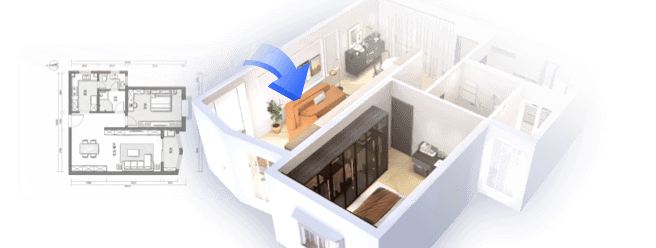
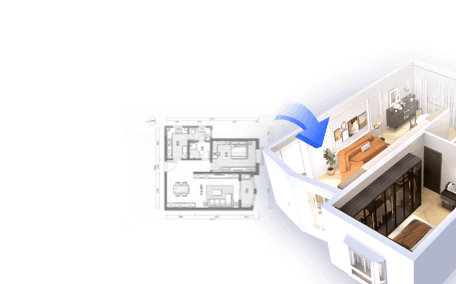
Discover the joy of home design with Homestyler! This user-friendly platform offers an intuitive online design tool, stunning 3D renderings, and a wealth of design projects. Plus, with helpful DIY video tutorials, you’ll be inspired to create your dream space effortlessly.
지금 무료로 디자인하세요