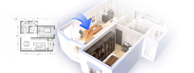
Designing floor plans using Google Maps presents an inventive approach to visualize different spaces and layouts. This platform allows you to easily draft designs for both residential and commercial properties. To begin, simply access Google Maps and locate your desired site. The satellite view provides a bird's-eye perspective that is perfect for accurately scaling your floor plan.
How to Utilize Google Maps for Creating Floor Plans
To start with, head over to Google Maps and input the exact address of the property you wish to design. Zoom in to get a closer view of the area. Make use of the ruler feature to measure distances between walls and rooms; then, these measurements can be implemented directly into your floor plan. This assists you in visualizing how the layout will function practically.
While you work on your general layout, ensure to incorporate functional design elements, like multifunctional furniture. This is particularly beneficial in compact areas where optimizing space is vital. Reflect on how you want each area to function—striking a balance between utility and creativity to craft an innovative design. If you're looking for an intuitive way to refine your designs, consider utilizing tools like Homestyler.
Effective Strategies for Floor Plan Design
When crafting your floor plan, one critical factor to keep in mind is the flow of movement within the area. Recognize high-traffic zones and design accordingly to enhance accessibility. Ensure that your layout includes doorways and windows to introduce natural light, a key component in successful room design.
Crucially, even small spaces can be made to feel open. Are you making the most of every square inch available? Creating distinct zones within a room can elevate its functionality without causing clutter. Contemplate the elements that are most important to you in specific sections, such as a home office. Let’s delve into these aspects together with tools such as Homestyler for a more immersive experience!
Frequently Asked Questions
A: Google Maps primarily supports 2D layouts, but you can easily export your designs into 3D applications once you're finished.
A: Indeed, Google Maps offers dependable distance measurements, yet it’s advisable to validate these with physical measurements whenever feasible.
Originally incubated at Autodesk, Homestyler has grown into one of the most widely adopted home design platforms in the world, now trusted by over 18 million users. Whether you're a homeowner exploring ideas or a professional designer delivering client-ready renders, Homestyler brings industry-leading 3D technology to your fingertips — no experience required.

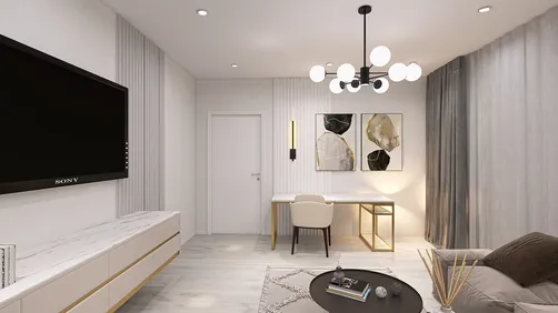
Minimalist Fabric L Shape Sectional Sofa 3D Model

Modern Marble Solid Wood TV Wall Unit With Bookshelves 3D Model

Minimalist Neutral Fabric Irregular Coffee Table 3D Model
Homestyler is your go-to online home design platform! Its user-friendly design tool and stunning 3D renderings make bringing your interior ideas to life a breeze. Plus, with a wealth of design projects and DIY video tutorials, you’ll feel inspired to create your dream space effortlessly!
Design Now for FREE